


Tennessee is a very different place when you get off the interstate.
The billboards disappear. The speed drops. Mountains replace exit signs. Around the next bend, you might find a waterfall, an old farm, a quiet valley or a view that makes everybody in the car reach for a phone.
And fall may be the best excuse to go looking.
Tennessee has scenic roads stretching from the Mississippi River side of the state to the Appalachian Mountains. Some are easy afternoon drives. Others climb thousands of feet into the mountains. One has so many curves that drivers come from far beyond Tennessee just to experience it.
If you have a free Saturday, a full tank of gas and no desire to hurry, these seven drives belong on the Tennessee road-trip list.
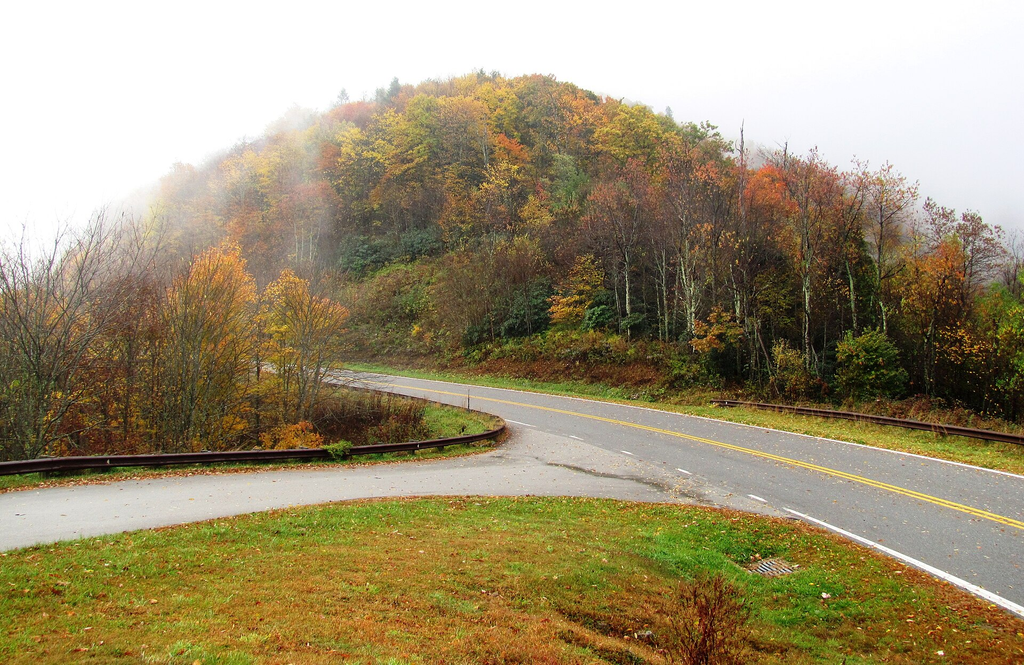
Cherohala Skyway: Tennessee’s Drive Into the Clouds
Start in Tellico Plains and point the car toward North Carolina.
The Cherohala Skyway runs 43 miles through the Cherokee and Nantahala national forests. The U.S. Forest Service describes it as a destination for scenic driving, with mountain overlooks, access to trails and views across the Tennessee Valley.
This isn’t a flat Sunday cruise.
According to Tennessee’s scenic byways guide, the road reaches elevations around 5,400 feet. That elevation is part of what makes the route especially interesting during fall, when drivers can see layers of mountains stretching into the distance.
The Cherohala Skyway Visitor Center in Tellico Plains is a sensible first stop before heading into the mountains.
And remember: This is one drive where the journey really is the attraction. Don’t plan it like you’re trying to beat Google Maps.
Cades Cove: 11 Miles That Can Take Half a Day
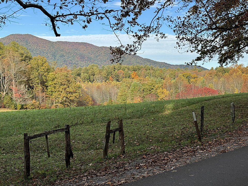
Cades Cove proves that a scenic drive doesn’t need to cover 100 miles.
The famous loop inside Great Smoky Mountains National Park is only 11 miles long. But the National Park Service recommends allowing at least two to four hours to drive it. The one-way road circles a mountain valley with access to historic homesites, churches, cemeteries, hiking trails and wildlife-viewing areas.
There’s a catch.
Traffic can become heavy during summer and fall and on weekends throughout the year. If wildlife appears near the road, things can slow down even more.
For 2026, the National Park Service says Cades Cove Loop Road is generally open from sunrise to sunset, weather permitting, but is closed to vehicles on Wednesdays during the seasonal vehicle-free period that typically runs from May through September.
In other words, check the park’s current conditions before making the drive.
Natchez Trace Parkway: Middle Tennessee’s Long, Slow Escape
Middle Tennesseans don’t have to drive east to find a great road.
The Natchez Trace Parkway ends near Tennessee Highway 100, about 17 miles southwest of downtown Nashville. From there, the parkway continues south for 444 miles through Tennessee, Alabama and Mississippi.
You don’t need to drive anywhere close to the whole thing.
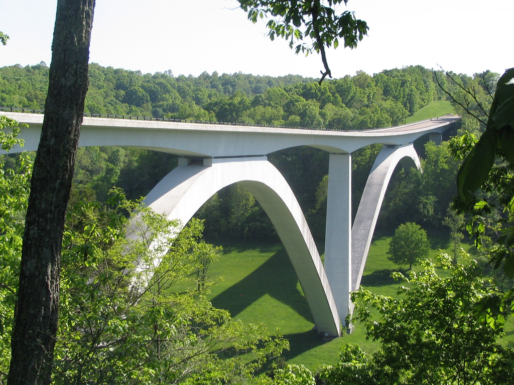
The Tennessee stretch alone includes hills, historic sites, picnic areas and the striking Double Arch Bridge near Birdsong Hollow. The National Park Service lists the bridge at milepost 438, just a few miles from the parkway’s northern end.
There’s another reason the Trace feels different from an ordinary highway: it was built as a recreational parkway, not simply a faster way to get from one city to another.
The speed limit is generally 50 mph unless otherwise posted, and there are no gas stations, restaurants or hotels directly on the parkway. Cell service can also be spotty.
Fill the tank first.
Cherokee National Forest: Pick a Road and Slow Down
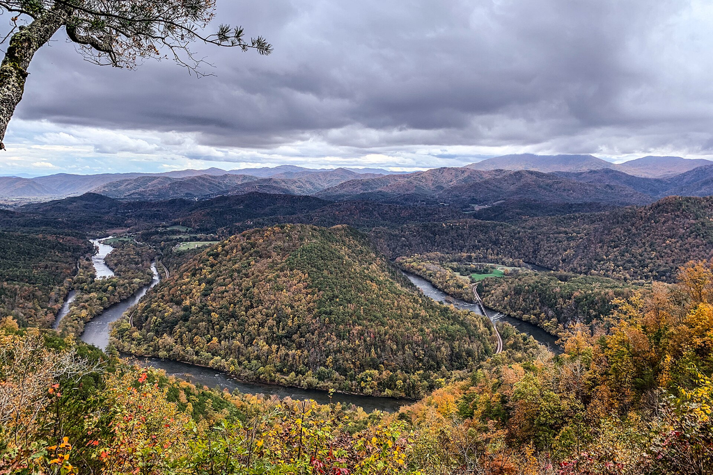
The Cherokee National Forest gives East Tennessee drivers something the average road trip cannot: options.
Lots of them.
The forest covers more than 660,000 acres in Tennessee and is divided into northern and southern sections by Great Smoky Mountains National Park. It contains hundreds of miles of trails, waterfalls, rivers and scenic roads.
That makes it less of a single scenic drive and more of a road-trip playground.
One option is the Paint Creek Corridor in Greene County, where Forest Road 41 follows Paint Creek for about five miles. The Forest Service points visitors toward waterfalls, picnic opportunities and the creek itself along the route.
Farther northeast, U.S. 321 and Tennessee 67 follow Watauga Lake and offer views of the water, forest and surrounding mountains.
Just check current Forest Service conditions before choosing smaller roads. Weather, maintenance and seasonal restrictions can affect access.
Deal’s Gap: The Scenic Drive That Demands Your Attention
Some roads are relaxing.
U.S. 129 at Deal’s Gap is not exactly one of them.
The mountain stretch near the Tennessee-North Carolina line is famous among motorcyclists and sports-car drivers. The Tennessee Department of Safety has described an 11-mile section containing 318 curves.
That number explains the road’s appeal — and why this isn’t the place for distracted sightseeing from behind the wheel.
Passengers can enjoy the scenery. Drivers should enjoy the pavement.
The route’s sharp turns have made it a destination in its own right, but its reputation shouldn’t be mistaken for permission to treat a public highway like a racetrack.
Take your time and save the mountain photos for a safe stopping place.
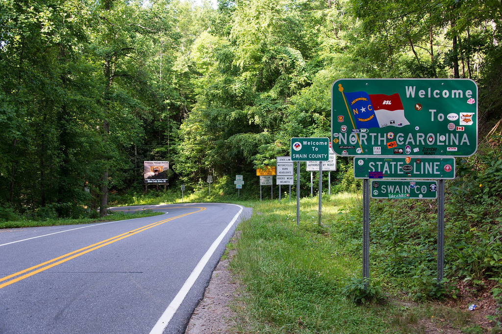
Great Smoky Mountains: More Than One Famous Loop
Cades Cove gets plenty of attention, but it isn’t the only way to see the Smokies through a windshield.
The National Park Service lists several Foothills Parkway sections as alternative scenic drives, including stretches between Walland and Wears Valley and between Chilhowee and Walland.
Then there’s Newfound Gap Road, one of the park’s main roads.
Unlike some secondary mountain roads, Newfound Gap Road, Little River Road and Cades Cove Loop Road are generally open throughout the year, weather permitting. Other roads can close seasonally.
That “weather permitting” part matters. Conditions in Tennessee’s high country can change quickly, especially later in the year.
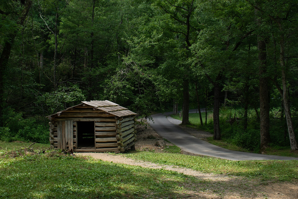
Don’t Forget the Roads Between the Famous Roads
Tennessee’s best scenic drive may not have a famous name at all.
The state’s scenic byway network includes routes through mountain country, river valleys and rural communities. TDOT said in 2023 that Tennessee had 13 state scenic byways, including 10 routes carrying a National Scenic Byway or All-American Road designation.
That’s the larger lesson for a Tennessee road trip.
You don’t have to drive every mile of the Natchez Trace. You don’t have to battle peak traffic in Cades Cove. And you certainly don’t have to tackle 318 curves to find a memorable view.
Sometimes the better plan is simply to choose a corner of Tennessee you haven’t explored, leave enough time for the slower road and stop when something catches your eye.
Just check road conditions before leaving, especially in mountain areas, and keep the sightseeing for overlooks and safe pull-offs.
The interstate will still be there when it’s time to come home.
Sources
- Tennessee Department of Transportation, Tennessee Scenic Byways guide.
- U.S. Forest Service, Cherokee National Forest and Cherohala Skyway information.
- National Park Service, Great Smoky Mountains National Park and Cades Cove visitor information.
- National Park Service, Natchez Trace Parkway visitor and route information.
- Tennessee Department of Safety, U.S. 129/Deal’s Gap information.
- Source article supplied by the user: Only In Your State, “10 Majestic Tennessee Country Roads To Explore on a Scenic Drive,” updated Sept. 22, 2026.