

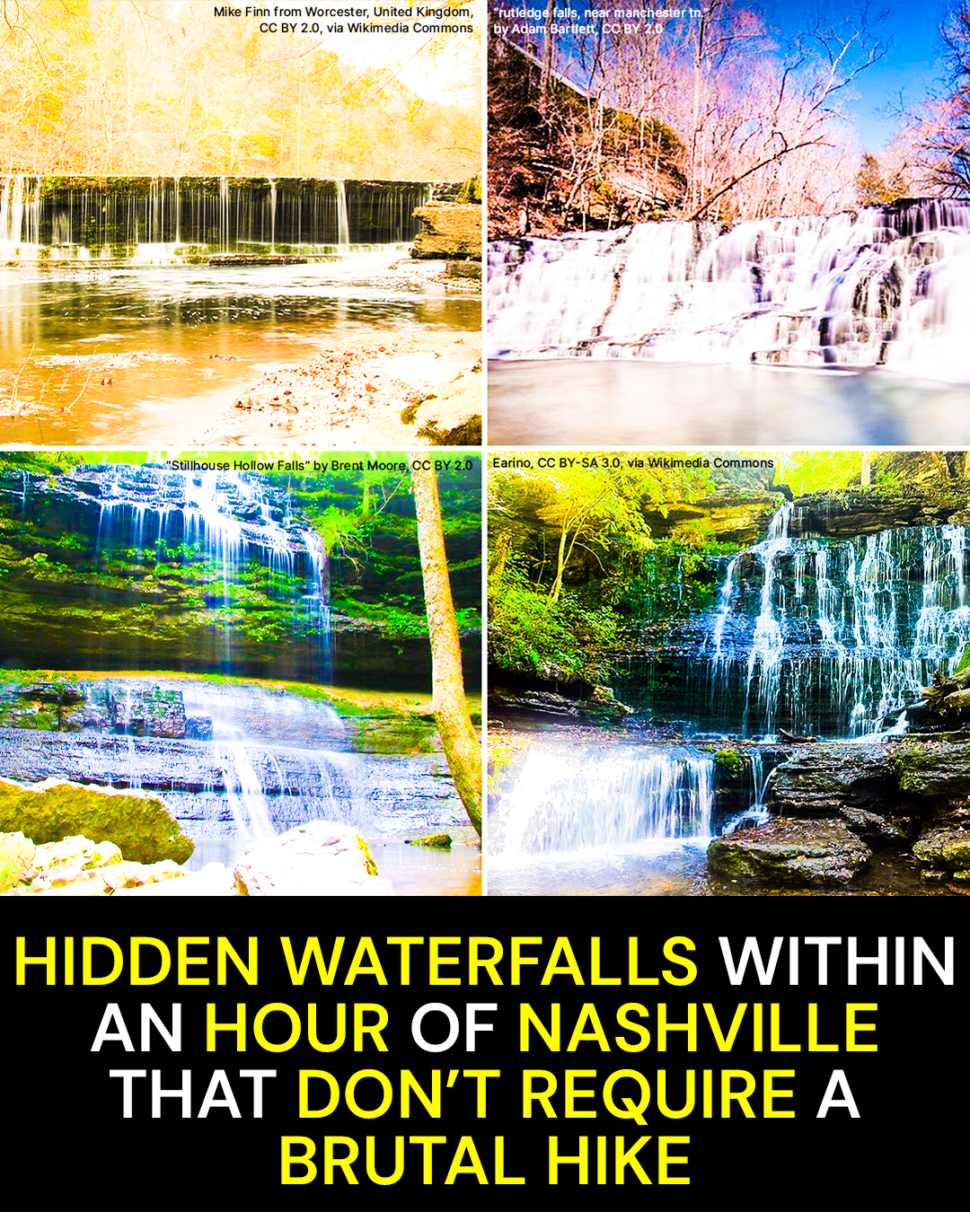
Nashville travelers can spend an hour driving toward a famous Tennessee waterfall, then discover another hour of hiking is waiting when they arrive. It does not have to work that way.
After comparing trail distances, state park information, National Park Service guidance, and the waterfalls commonly labeled “near Nashville,” a much easier group stands out. Some require only minutes on foot. One is actually inside Nashville. And a few popular picks stretch that one-hour drive more than travel guides admit.
The Waterfall Hiding at the End of a Nashville Street
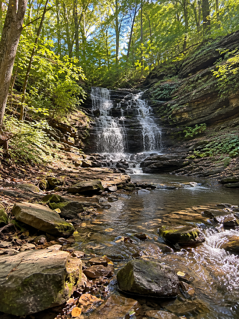
West Meade Waterfall sits just 12.2 miles from downtown Nashville in the West Meade neighborhood, at the end of Hathaway Court off Jocelyn Hollow Road. There is essentially no hike. The waterfall can be viewed beside the road, making this the easiest outing in the entire group.
That location is half the fun.
You are not winding along a mountain highway or pulling into a sprawling state park. You are driving through a quiet residential area in western Nashville, the kind of place where you would expect lawns, mailboxes, mature trees, and cul-de-sacs.
Then limestone and falling water appear beneath a shady canopy.
The protected land surrounding the falls covers about 3.77 acres. TennGreen Land Conservancy acquired it in 2013 before the property was transferred to Metro Nashville Parks for West Meade Waterfall Park. The falls form the headwaters of Richland Creek, with the surrounding woods providing habitat for salamanders, wildflowers, and other wildlife.
It feels strangely removed from the city considering how little effort it took to reach it.
Here’s what catches people off guard.
West Meade can turn from a substantial rushing waterfall after rain into little more than a trickle during a dry spell.
That makes timing more important here than hiking ability.
The insider move is simple: watch the weather. Visit after Nashville has received a decent rainfall rather than during a long, dry stretch of summer. Spring and post-rain periods are especially good bets.
There is no reason to put on a backpack and prepare for an expedition. Tennessee tourism information specifically describes the falls as viewable from the road without a hike.
But easy access comes with a responsibility that matters more here than at almost any other waterfall on this list.
This is a neighborhood.
Do not block a driveway, spread out across the street, leave trash, wander onto neighboring private property, or turn the cul-de-sac into your personal state park. TennGreen specifically asks visitors to be respectful of the residential setting.
The trap is arriving after weeks without rain because you saw a dramatic photograph online. West Meade is not a dependable roaring waterfall every day of the year.
Catch it at the right moment, though, and it may be the most surprising waterfall stop in Nashville.
The next one requires a little more walking, but its story goes back more than 200 years.
The Waterfall That Comes Straight Through a Limestone Ridge
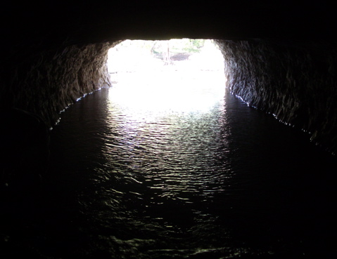
The Montgomery Bell Tunnel waterfall is reached on the Tunnel Trail at Narrows of the Harpeth, part of Harpeth River State Park near Kingston Springs. The trail is only 0.20 mile and is officially rated easy, making it one of the strongest choices for anyone who wants history and scenery without committing to a long hike.
This is not your standard Tennessee waterfall.
Follow the base of the limestone bluff and you eventually reach a dark opening cut directly through the ridge.
Water comes through it.
That is when the place starts making sense.
Construction on the tunnel began in 1818 and was completed around 1820. Enslaved laborers cut the passage through the limestone so Harpeth River water could be diverted to power Montgomery Bell’s iron operation.
The tunnel runs roughly 290 feet through the ridge.
At the outlet, the diverted water emerges and creates what Tennessee State Parks describes as a man-made waterfall. It is part scenic stop, part industrial archaeology, and part reminder that some of Tennessee’s prettiest landscapes carry difficult human history.
You hear moving water against stone. The bluff rises beside the trail. The tunnel opening looks almost too precise against the natural limestone around it.
Here’s what catches people off guard.
You are looking at a waterfall created by a roughly 200-year-old water tunnel cut through solid limestone.
The best trick here is knowing which trail to take.
Stick with the Tunnel Trail if the waterfall is your goal. It is short, natural-surfaced, and has minimal overall elevation gain, although brief grades can reach around 20 percent.
The nearby Bluff Trail is another matter. It climbs much more steeply toward an overlook.
That overlook can be worth the effort for hikers who want it, but nobody needs to climb the bluff just to see the tunnel waterfall.
Recent rain can make the water emerging from the tunnel noticeably more impressive. Like several Middle Tennessee waterfalls, this one benefits from good water conditions rather than a long dry spell.
Wear shoes with traction even though the walk is short. Natural surfaces and water are a better argument for decent footwear than mileage is.
And remember what you are looking at.
The scenery may be peaceful now, but this was once working infrastructure built through enslaved labor for Tennessee’s early iron industry.
From there, the next waterfall looks much more like something you would expect to find miles into the woods. The trick is that the trail is only 900 feet long.
The 900-Foot Trail That Feels Easier Going Down
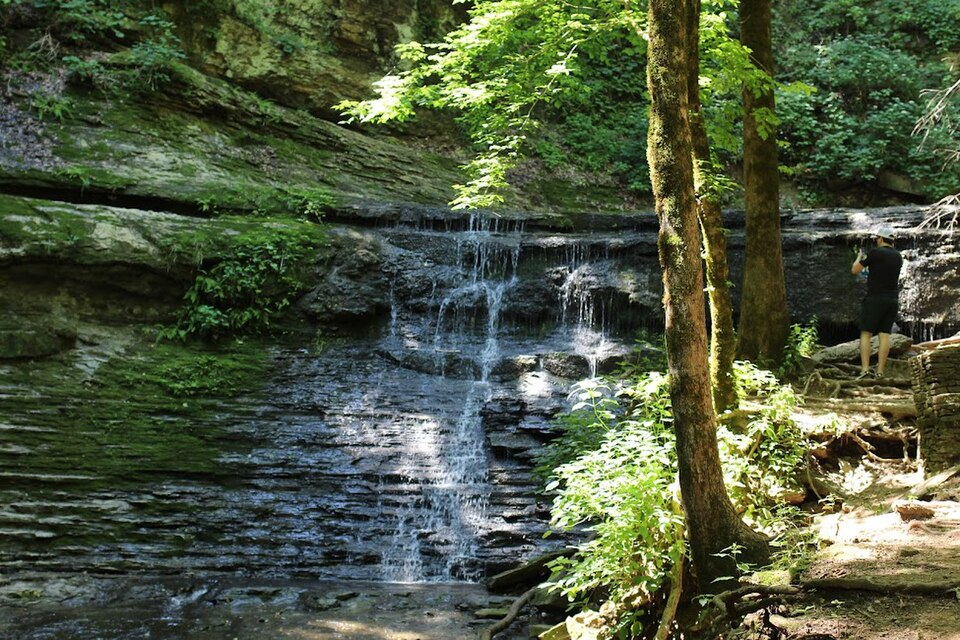
Jackson Falls sits at Milepost 404.7 on the Natchez Trace Parkway southwest of Nashville. The National Park Service maintains the site, and the waterfall is reached by a paved trail measuring only about 900 feet each way.
That sounds almost ridiculously easy.
There is a catch.
The path drops quickly.
You leave the parking area and descend into hardwood forest, with the road and cars disappearing behind you much faster than the short mileage suggests.
The pavement changes the character of the outing. Instead of picking through roots for miles, you follow an engineered path downhill toward the falls.
Then water appears against the rock below.
Jackson Falls has that enclosed woodland feeling people often associate with much longer Tennessee hikes. Trees crowd the slopes, exposed stone holds moisture, and the waterfall spills into a scene that feels far more remote than a 900-foot trail should allow.
Here’s what catches people off guard.
The trail is paved and only about 900 feet long, but the National Park Service describes it as steep, so the return climb is noticeably harder than the walk down.
Save a little energy.
That is the insider tip here. Do not judge the hike by how effortless the first few minutes feel while gravity is doing half the work.
Jackson Falls also has a geological story that is easy to miss.
The falls formed through a process called stream piracy. Jackson Branch once followed a higher valley until erosion allowed the Duck River drainage to capture the stream and redirect it over the bluff. The waterfall records that change in the area’s drainage pattern.
The site has parking, picnic facilities, scenic viewing, and trail access. Restroom conditions have varied because of plumbing problems, so do not build your entire pit-stop strategy around finding an operating restroom here.
There are two rules worth taking seriously.
Swimming and bathing at Jackson Falls are prohibited under current Natchez Trace Parkway regulations. The National Park Service also warns visitors not to climb the waterfall because wet rocks can be extremely slippery.
The trap is assuming paved means flat, or safe for wandering onto wet rock.
Water volume varies seasonally. Late winter, spring, and periods following rain generally offer stronger flow, while fall trades some of that water drama for hardwood color.
If you have extra time, combine the stop with nearby Baker Bluff instead of driving all this way just to photograph the falls and immediately turn around.
But continue farther down the Natchez Trace and there is another waterfall where you may hear the payoff before you have really started hiking.
The Waterfall You Can Hear Almost as Soon as You Park
Fall Hollow sits at Milepost 391.9 on the Natchez Trace Parkway. The waterfall drops about 20 feet, and the National Park Service lists the waterfall trail at roughly 1,025 feet, making this another outing measured in minutes rather than miles.
You get out of the vehicle and the woods are already doing the sales pitch.
Moving water can be heard almost immediately.
That sound draws you forward through the trees toward the hollow. Instead of spending an hour wondering when the scenery is going to start, you get the sense that the destination is close from the beginning.
The waterfall itself is not the tallest in Middle Tennessee.
That is not really the point.
The reward-to-distance ratio is what earns Fall Hollow a place here.
Here’s what catches people off guard.
Fall Hollow is a very short walk, but current National Park Service descriptions warn of natural ground, rocks, roots, steep sections, unstable footing, and steep drop-offs.
Call this one short, not effortless.
That distinction matters, particularly if someone in your group has limited mobility or poor balance.
Older descriptions can make the outing sound like a simple little roadside stroll. The reality is that a thousand-foot trail can still demand attention when roots, moisture, and uneven terrain are involved.
Wear shoes that grip.
Platforms and rocks around the falls can remain damp, and the National Park Service warns against climbing on waterfall rocks. Swimming is prohibited here under current Parkway regulations as well.
The insider move is to treat Fall Hollow as part of a Natchez Trace drive rather than a standalone expedition. The Parkway itself is part of the pleasure, especially when Tennessee’s hardwoods begin changing color.
The trap is getting fooled by the tiny trail distance and arriving in slick casual shoes.
A 1,025-foot trail does not sound intimidating because it isn’t long.
But limestone, roots, and water do not care how many miles are showing on your fitness tracker.
The next waterfall stretches the one-hour rule depending on where in Nashville you start, but the 75-foot drop makes the extra drive tempting.
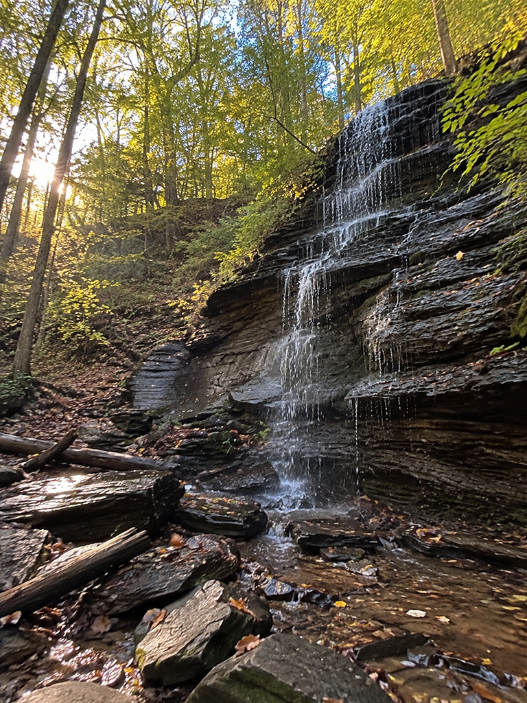
The 75-Foot Drop Where Parking Can Be Harder Than the Hike
Stillhouse Hollow Falls State Natural Area sits about 66 miles south of Nashville, which means travelers leaving downtown should expect it to stretch beyond a strict one-hour drive under many conditions. The natural area covers roughly 90 acres, and its centerpiece is a waterfall dropping about 75 feet into a wooded hollow.
This is where the landscape begins to feel deeper and wilder.
The trail descends through forest toward the hollow. Wooden scenery gives way to damp earth, rock, and the cooler air you often notice when dropping toward a shaded Tennessee creek.
Then the waterfall appears beneath the Highland Rim.
Water spills over the rock face into the hollow below, surrounded by a forest that can make the scene look far more isolated than it actually is.
You do have to hike for this one.
The walk to the waterfall is about two-thirds of a mile from the trailhead, making the outing roughly 1.2 to 1.4 miles depending on where you turn around. Tennessee tourism information rates the hike moderate rather than easy.
Here’s what catches people off guard.
At Stillhouse Hollow, finding a legal parking space can be a bigger problem than completing the relatively short trail.
Parking is extremely limited.
When the designated spaces are full, the state considers the natural area at capacity. Visitors may not simply improvise a parking space elsewhere and walk in. Weekdays and non-peak times are specifically recommended.
That is the insider tip worth remembering before you leave Nashville.
Go early, or go on a weekday.
Do not make the classic Tennessee waterfall mistake of arriving at peak time, finding every legal space occupied, and deciding the shoulder of the road looks close enough.
Spring is particularly appealing here.
The natural area supports trillium, spiderwort, wild geranium, phlox, oakleaf hydrangea, and azalea. Combine those blooms with stronger seasonal waterfall flow and the whole hollow can feel completely different from a dry late-summer visit.
Dogs are allowed, but they must remain on leash.
Wear actual walking shoes. This is not a flip-flops trail just because the mileage is modest. The natural path descends into the hollow and includes uneven terrain.
And be honest about the drive.
From downtown Nashville, Stillhouse Hollow commonly falls outside a strict 60-minute window. It belongs here as a worthwhile stretch, not because somebody shaved 15 minutes off the drive time to make a prettier headline.
The next stop stretches the drive too, but the actual walk to the waterfall is almost comically short.
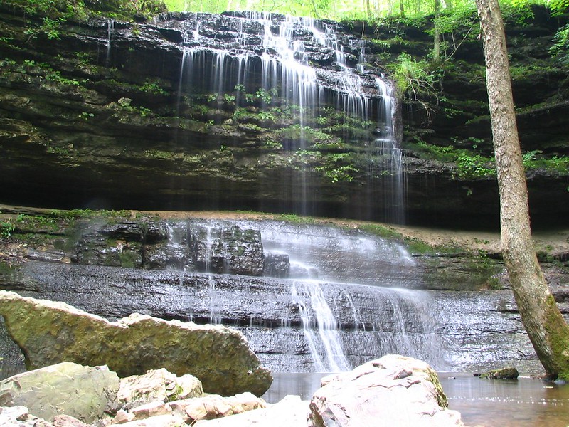
The Waterfall Where You May Spend Longer Parking Than Walking
Rutledge Falls near Tullahoma is generally a little beyond a strict one-hour drive from downtown Nashville, but the trail itself could hardly fit this article better. The route is about 0.2 mile round trip, gains roughly 29 feet, and can involve only about five minutes of walking.
That is barely enough time to settle into hiking mode.
The setting changes quickly as you leave the roadside behind and follow the short route toward the water.
Then the falls appear.
Regional hiking sources place Rutledge Falls at roughly 40 feet high. Water spills across the rock in a broad wooded setting that photographs like the destination of a much longer hike.
There is also a detail that separates Rutledge from a normal state park visit.
This is private property.
The landowners allow the public to visit, and visitors generally park near Rutledge Falls Baptist Church before walking toward the trail entrance.
Here’s what catches people off guard.
Rutledge Falls is privately owned land where public access exists because the property owners allow it.
Treat that access like the privilege it is.
Stay on the established route, obey any posted rules, pack out what you bring in, and do not behave as though every patch of ground around the falls belongs to the public.
There is a fun bit of Tennessee pop culture here too.
Rutledge Falls has a connection to Hannah Montana: The Movie, which filmed in Tennessee and used the area as a filming location.
For a certain generation, that may be nearly as interesting as the waterfall.
The practical appeal is obvious. You get substantial scenery without dedicating half a day to hiking.
The trap is forgetting that easy access can disappear if visitors stop respecting the people who own the property.
No trail fee or long climb can substitute for good manners here.
And if a five-minute waterfall walk feels almost too easy, the next stop gives you a little more trail while paying you back with a much larger waterfall and several bonus cascades.
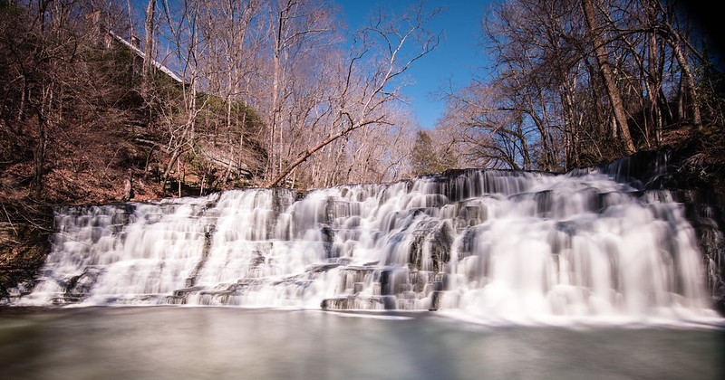
The Short Trail System That Keeps Producing More Waterfalls
Machine Falls lies within Short Springs State Natural Area about 3.5 miles northeast of Tullahoma. The waterfall drops more than 60 feet and spreads nearly as wide as it is tall, while the commonly used route is approximately 1.6 miles round trip and rated moderate.
This one asks more of your legs.
It still does not require an all-day Tennessee backcountry march.
The trail moves through a landscape shaped by the transition between the Highland Rim and Central Basin. Exposed Chattanooga shale appears among mountain laurel, sycamores, magnolias, beech, and tulip poplar.
In spring, the forest floor gets another layer.
Trout lilies, Virginia bluebells, trillium, larkspur, and jack-in-the-pulpit are among the wildflowers associated with Short Springs. Tennessee recognizes the area as one of the state’s notable spring wildflower locations.
Then you reach Machine Falls.
The water spreads across the rock instead of dropping in one skinny ribbon, which gives the waterfall a broad, textured appearance.
Here’s what catches people off guard.
Machine Falls is not the only waterfall payoff at Short Springs, because the natural area also contains Upper Busby Falls, Lower Busby Falls, and Adams Falls or cascades.
Do not rush straight to the namesake falls and immediately head back to the car.
The Busby waterfalls can be seen from overlooks along the Bobo Creek trail, giving waterfall hunters more scenery from one trail system.
Parking is where things get less carefree.
Spaces are extremely limited. When all legal designated spaces are occupied, the state considers Short Springs at capacity and asks visitors not to park elsewhere. Dogs must remain leashed.
That makes an early or off-peak visit far more relaxing.
The trail is moderate rather than effortless, so bring water and wear footwear with traction. A short hike through a wet natural area can become annoying in a hurry if your shoes have smooth soles.
The trap is thinking 1.6 miles guarantees an easy stroll.
Distance is only one part of waterfall hiking. Roots, slopes, moisture, and uneven natural surfaces count too.
Still, this is exactly the kind of place that makes Middle Tennessee waterfall hunting rewarding. You can walk for a manageable distance and come home with several completely different scenes.
The next stop adds something even older than the waterfalls: an ancient ceremonial landscape that people sometimes misunderstand before they even arrive.
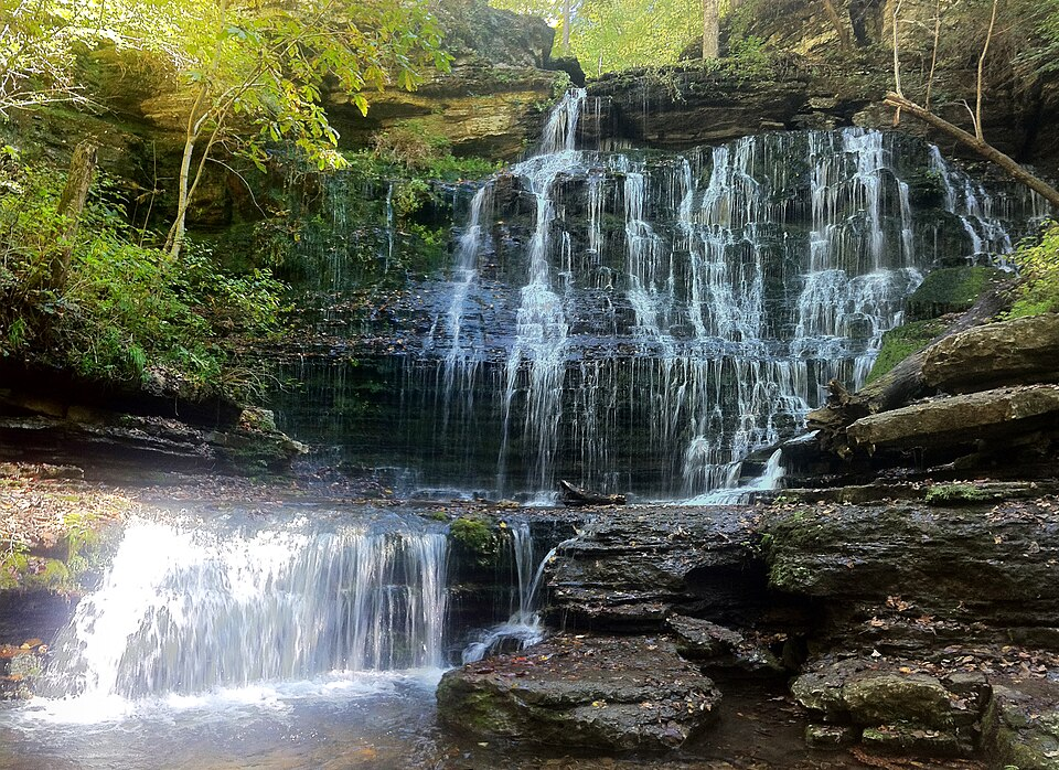
The Ancient Tennessee Site With Waterfalls Built Into the Landscape
Old Stone Fort State Archaeological Park near Manchester is another destination that generally stretches beyond the headline’s strict one-hour drive from downtown Nashville. Once there, however, visitors can see several waterfalls without committing to an all-day hike. The park contains nearly ten waterfalls and cascades, with Blue Hole Falls, Big Falls, and Step Falls among the best known.
First, forget what the name seems to tell you.
Old Stone Fort was not a military fort.
The prehistoric enclosure was created by Native peoples roughly 1,500 to 2,000 years ago and appears to have held ceremonial importance.
The surrounding rivers and drops are part of what makes the setting so striking.
Water runs across broad shelves of stone. At Step Falls, the river works down repeated tiers. Blue Hole Falls and Big Falls each drop about 30 feet.
The sound of moving water follows portions of the route, and the broad riverbed gives these falls a different character from the narrow woodland drops elsewhere on this list.
Here’s what catches people off guard.
You do not have to walk the entire park loop to see Old Stone Fort’s waterfalls.
That is the insider trick.
The roughly 1.4-mile Enclosure Trail can connect the major waterfall areas, but shorter outings are possible. A detailed trail guide estimates about 0.4 mile round trip for Blue Hole Falls alone, around 0.6 mile for Step Falls, roughly one mile for Blue Hole and Big Falls, and about 1.4 miles for all three.
If somebody in your group wants waterfalls but not a long walk, pick one or two instead of automatically completing the loop.
Blue Hole is particularly useful for a short visit because it is close to the museum area.
Bring shoes with traction and pay attention near wet rock and moving water. Short trail mileage should never be mistaken for permission to scramble wherever you please.
The trap here is treating the archaeological landscape as scenery around the waterfalls.
It is the other way around.
The cultural history is central to the place, and the water, river forks, and terrain help explain why this landscape mattered long before modern Tennessee parks existed.
After a history-heavy stop like this, there is one last thing worth understanding about Nashville-area waterfalls.
The easiest-looking ones can sometimes be the ones that demand the most common sense.
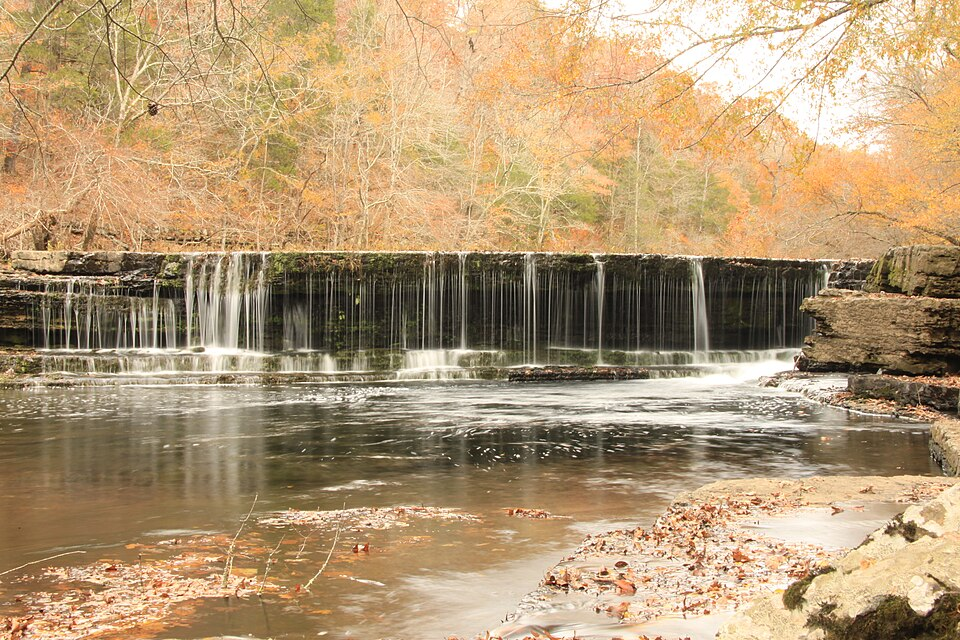
The Unexpected Fact About Nashville-Area Waterfalls
The surprising thing about waterfall hunting around Nashville is how poorly trail mileage predicts the experience.
West Meade requires practically no hiking at all. The Montgomery Bell Tunnel Trail is only 0.20 mile. Jackson Falls is reached by a 900-foot paved path. Fall Hollow’s trail is only about 1,025 feet. Yet each comes with a completely different catch: rainfall, history, steep grades, slippery rock, private-property etiquette, tiny parking lots, or rough footing.
Middle Tennessee also rewards people who understand timing.
Late winter through spring generally offers a strong combination of waterfall flow and comfortable exploring. Recent moderate rain can wake up seasonal features such as West Meade, while spring adds wildflowers at places including Stillhouse Hollow and Short Springs. Extended summer dry spells can reduce smaller falls dramatically.
Fall changes the bargain again. Flow may be lower, but the Natchez Trace trades some water volume for hardwood color. Winter opens views through bare trees, although ice can turn short waterfall paths into much more serious terrain.
And that may be the best insider lesson of all.
You do not need an eight-mile hike to find falling water around Nashville, but you do need to know when to go, where to park, and when a “short” trail deserves more respect than its mileage suggests.
Sometimes the best Tennessee scenery is not miles into the wilderness. Sometimes it is only a few careful minutes from the car.
Reframe the list around the one-hour limitAdd a quick comparison table