

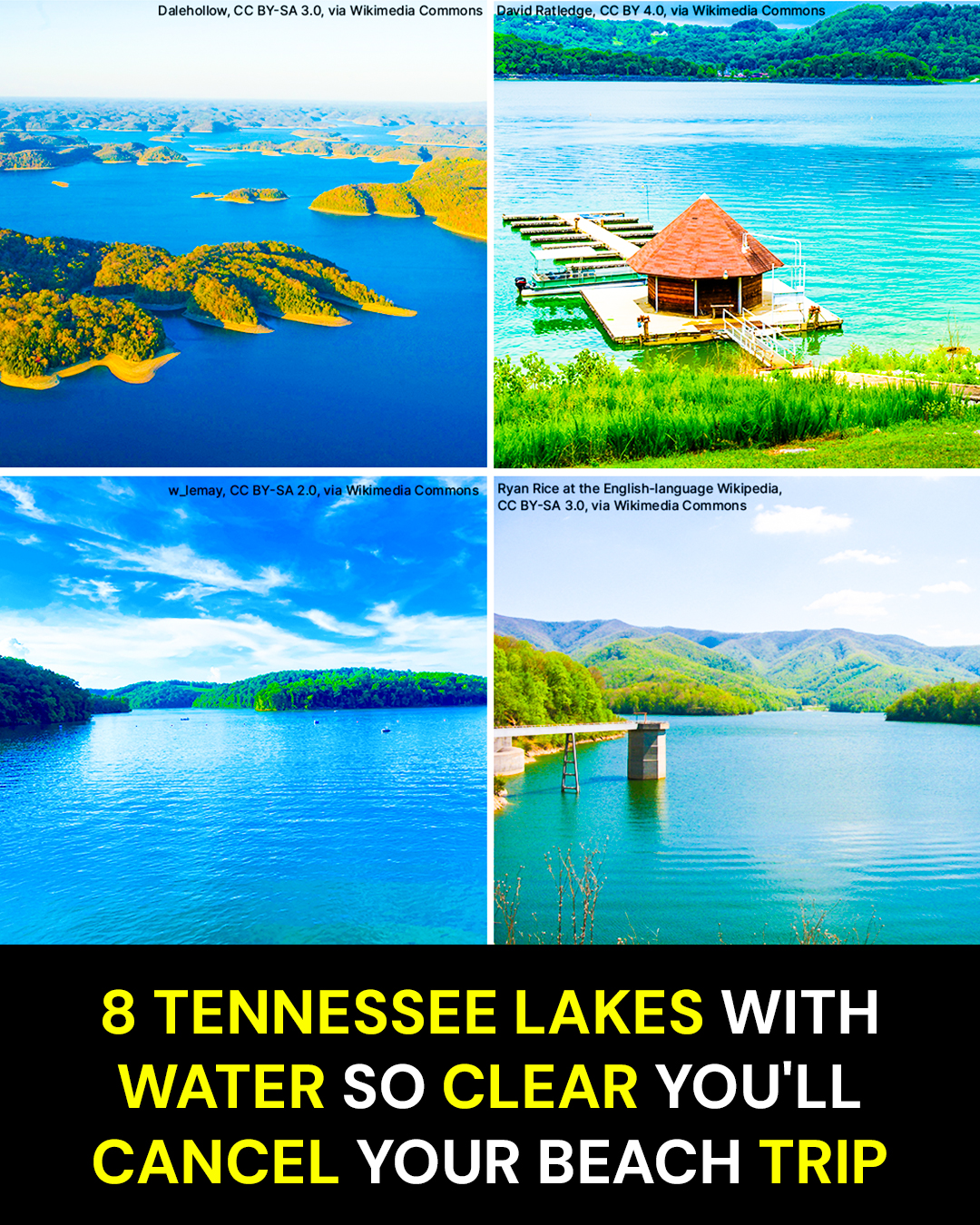
Driving from Nashville to Gulf Shores takes about 7 hours and 7 minutes before traffic, food stops, and the inevitable bathroom break even enter the picture. Tennessee has another option: mountain lakes with blue-green water, sandy swimming areas, quiet coves, and shorelines that can make the Gulf feel a whole lot farther away than necessary.
These eight stood out after digging through TVA, Forest Service, Army Corps, state wildlife, and recreation information. Water clarity changes with rain, season, and location, so this is not a laboratory ranking. But a few of these lakes can look downright tropical on the right Tennessee afternoon.
The Lake That Makes East Tennessee Look Almost Tropical
Norris Lake spreads across roughly 34,000 acres north of Knoxville, with an extraordinary 809 miles of shoreline winding through Anderson, Campbell, Claiborne, Grainger, and Union counties. TVA calls it the largest reservoir on a tributary of the Tennessee River.
Norris is the easy place to start because the water does half the talking.
On a bright summer morning, wooded ridges drop toward coves where the color shifts from deep blue to green, then turns lighter near rocky shallows. Boats disappear around bends in the shoreline, and another quiet finger of water opens ahead.
There are marinas, houseboats, pontoons, campsites, hiking trails, and enough shoreline that one end of the lake can feel completely different from another.
This is not a little state-park pond dressed up for Instagram.
Here’s what catches people off guard.
Norris has more than 800 miles of shoreline, enough to make a weekend feel more like exploring a region than visiting a single lake.
For a beach-style day, look toward established recreation areas around the reservoir rather than simply pulling onto an unfamiliar shoreline. Loyston Point is one of the names worth knowing, and Norris Dam State Park and Big Ridge State Park give travelers more options for turning a swim into a full day.
The insider move is getting on the water early. Morning light catches the wooded hills beautifully, the lake is calmer before heavier boat traffic arrives, and paddling is considerably more peaceful.
Bring water shoes. Norris has beautiful shorelines, but Tennessee reservoir bottoms are not the powdery Gulf sand your feet may be expecting. Rocky edges are part of what makes the water look so good.
Also remember that Norris is a working TVA reservoir. Water levels can vary substantially between summer and winter, so a shoreline photograph from July may look very different from the same cove later in the year. TVA says normal annual fluctuation is about 29 feet.
The trap is assuming “clear” means conditions never change. Rain, runoff, boat wakes, and seasonal water levels can alter visibility quickly.
Norris is big, polished, and easy to love.
But the next lake proves you do not have to go nearly as far east to find water that looks surprisingly clean.
The Middle Tennessee Escape That Saves You the Gulf Drive
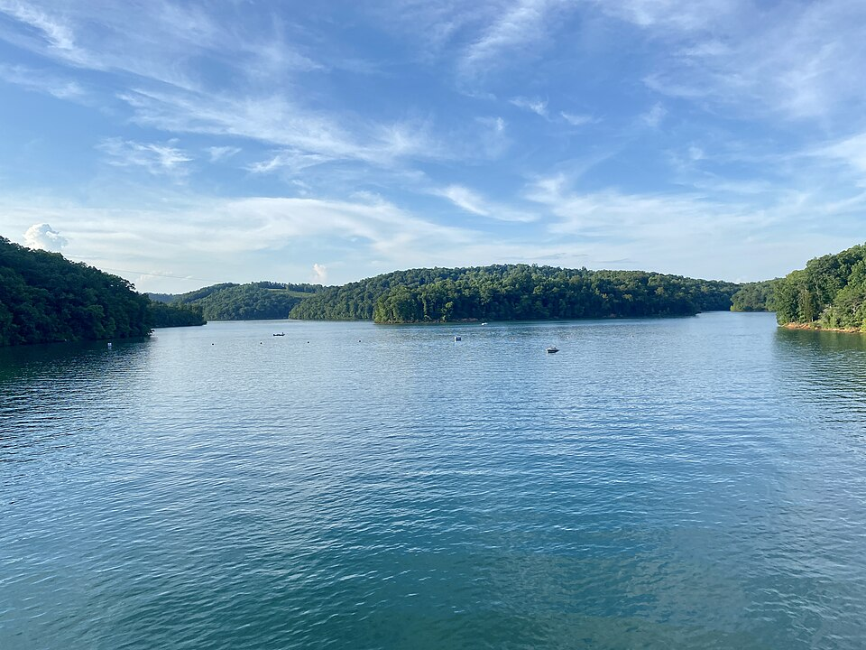
Center Hill Lake stretches about 64 miles along the Caney Fork River and carries roughly 415 miles of shoreline through Middle Tennessee. Tennessee tourism has promoted its crystal-clear water, while the Army Corps maintains swimming, camping, boating, and recreation areas around the reservoir.
This is the one Nashville-area travelers should remember.
The shoreline rises in wooded slopes and limestone bluffs. In quiet coves, the water takes on a dark green-blue color, especially where trees and rock reflect across the surface.
There is that familiar Tennessee lake smell here too: sun-warmed leaves, damp rock, sunscreen, and charcoal drifting over from a picnic area.
Then you step onto actual sand.
Here’s what catches people off guard.
The Army Corps operates three designated swimming areas at Center Hill, and all three have sand beaches.
Ragland Bottom Recreation Area and Floating Mill Day Use Area are the easiest names to remember for a beach day. Floating Mill Campground also has a swimming area, but that beach is for registered campers.
The insider tip is simple: use the designated swimming areas if swimming is the main purpose of the trip. Boat traffic is kept outside those marked zones, which makes them a much better choice than hopping into the water beside a launch ramp or marina.
At Ragland Bottom, the day-use area sits beside a swimming beach and includes picnic facilities, bathrooms, a playground, and a boat ramp. Pets and alcohol are prohibited in the day-use area and at the beach.
There is a day-use charge at the Corps beaches, so do not assume every lakeside parking lot is free simply because you are on public land. Parking can also tighten up on hot weekends.
Pack shade if you plan to stay for hours. A Tennessee lake beach in July still has Tennessee July heat.
And pay attention to where you swim. The Corps prohibits swimming at ramps, marinas, public docks, mooring points, and other posted locations. The marked beaches exist for a reason.
Center Hill also makes an easy base for a bigger Middle Tennessee getaway, with Edgar Evins State Park and the broader Caney Fork area close enough to build a full weekend around the water.
That sounds pretty good.
Then you get to the lake where houseboats, scuba divers, sandy beaches, and underwater history all meet in the same place.
The Lake Where the Vacation Starts Before You Reach Shore
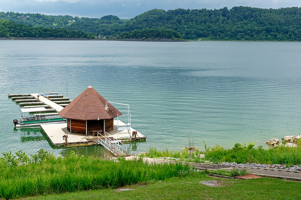
Dale Hollow Lake covers about 27,700 surface acres along the Tennessee-Kentucky line and carries roughly 620 miles of shoreline. The U.S. Army Corps of Engineers describes it as clear blue water surrounded by heavily forested country, with 15 commercial marinas serving boaters around the lake.
Dale Hollow feels built for lingering.
A pontoon slides through open water. Houseboats sit against green hillsides. Sand beaches break up long stretches of forest. Farther out, the color gets darker and deeper until the surface looks almost polished.
The lake has long been known for fishing, but staying above the water misses half the story.
Scuba divers come here too.
Here’s what catches people off guard.
Divers can visit the submerged foundation of the old Willow Grove Schoolhouse beneath Dale Hollow’s clear water.
That one detail changes the mood of the whole lake.
People were living, traveling, farming, and going to school in parts of this valley long before the reservoir existed. Dale Hollow Dam was completed during the 1940s, creating the lake visitors now cross in houseboats and fishing boats.
For swimmers, Obey River Day Use Area is hard to beat. Recreation.gov describes Obey River Park as having the largest and most visited swimming beach on Dale Hollow.
The insider tip is to arrive earlier than you think you need to. Obey River’s parking is first-come, first-served, and the beach is not some forgotten strip of sand known only to locals.
The day-use area operates from 6 a.m. to 10 p.m., and the current vehicle day-use charge is $5, paid by credit card at the automated station. Walk-ins are $2.
Bring the usual swim gear, but leave glass containers and alcohol behind. They are prohibited at Corps beach areas. Pets are also prohibited on the designated beaches.
Dale Hollow is additionally designated as a No Discharge Zone, meaning sewage discharge from vessels is prohibited, treated or untreated.
The trap here is thinking one afternoon is enough. Between the beaches, marinas, boating, camping, fishing, and underwater history, Dale Hollow works better as a stay than a stop.
And somehow the next lake feels even farther removed from ordinary Tennessee, mostly because you have to climb into the mountains to reach it.
Where a Tennessee Beach Sits Nearly 2,000 Feet Up
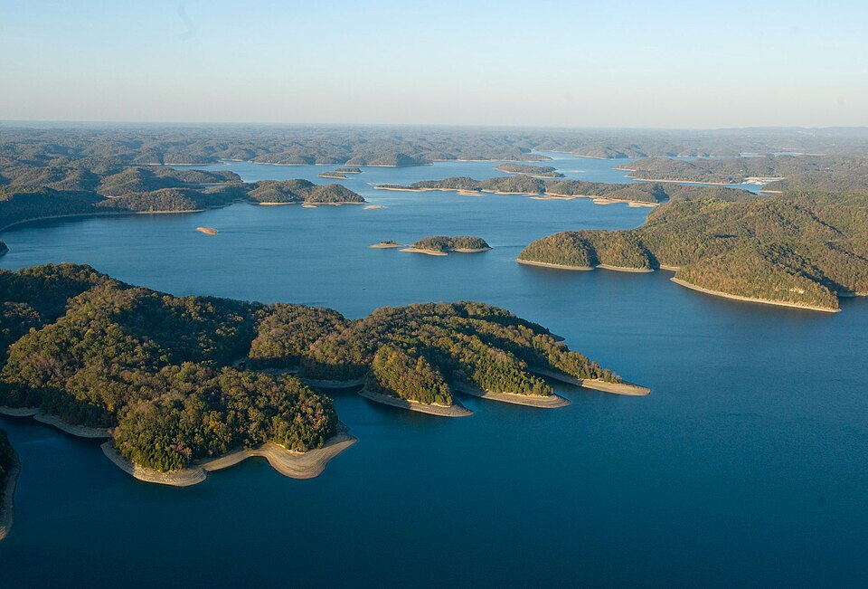
Watauga Lake covers about 6,430 acres in northeast Tennessee, with 105 miles of shoreline surrounded in large part by Cherokee National Forest. At more than 1,900 feet above sea level, it is Tennessee’s highest reservoir.
That elevation changes everything about the scene.
Instead of broad rolling hills, mountains rise directly beyond the water. Forested slopes stack behind one another in blue layers. On calm mornings, the surface reflects the ridges so cleanly that the shoreline almost seems doubled.
There is less of the big-marina atmosphere here and more of that Appalachian feeling that makes you lower your voice without quite knowing why.
You can hear paddles touching water. Wind moves through hardwoods. Somewhere across the lake, a boat motor becomes a faint hum and disappears behind a point.
Here’s what catches people off guard.
The Forest Service describes Watauga’s water as “notably clean” for recreation.
Cardens Bluff Campground sits on a peninsula overlooking the lake at nearly 2,000 feet. It has 43 campsites, primarily for tent camping, with flush toilets and showers for registered campers.
The insider move is to combine the lake with a little time on foot. The Appalachian Trail passes through the area around Watauga, and Big Laurel Branch Wilderness sits across the water from Cardens Bluff.
Watauga Point Recreation Area is another good base for picnicking, lake views, kayaking, and taking in the mountain setting. The Forest Service lists it as open for the 2026 season.
Cardens Bluff reopened on September 3, 2026 after a temporary closure, another reminder that mountain recreation facilities can change status with weather and maintenance.
One important current note: do not automatically build your day around Shook Branch Beach. Forest Service listings have shown the swim area closed, so check current conditions before making it the centerpiece of the trip.
Bring bear-country common sense if you are camping or picnicking. Food, trash, pet food, and scented items must be stored correctly in Forest Service recreation areas where the food-storage order applies.
The trap at Watauga is arriving with a rigid plan. Mountain facilities can close temporarily, and cell service is not something to take for granted in this part of the state.
Come for the water.
Stay because the mountains make it difficult to leave.
And if clear water is impressive from a kayak, the next place gets even more interesting when you put on a scuba mask.
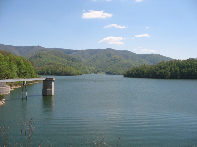
The Reservoir Clear Enough to Attract Scuba Divers
South Holston Lake covers about 7,600 acres with 182 miles of shoreline near Bristol and the Virginia line. Roughly 60 percent of its shoreline is bordered by Cherokee National Forest, and TVA specifically notes that the reservoir is popular with scuba divers because of its depth and clarity.
That tells you something.
This is not bright, shallow swimming-pool water. South Holston often carries a darker mountain-blue look, especially as the bottom drops away.
Near shore, rock and gravel appear beneath the surface. Farther out, the water seems to swallow the light.
The surrounding forest does the rest. Long stretches of green shoreline make development disappear, and when the lake is quiet, the whole place feels much farther from Bristol than it really is.
Here’s what catches people off guard.
South Holston averages roughly 86.5 feet deep, which helps give parts of the reservoir that dark, almost northern-lake appearance.
The insider tip for 2026 is more important than any secret cove: verify access before leaving home.
Historically, Jacobs Creek Recreation Area has been one of the better-known developed swimming spots on South Holston, and Little Oak has provided lakeside camping and access.
Right now, Forest Service listings show both Jacobs Creek and Little Oak closed because of Hurricane Helene impacts.
That does not mean South Holston itself is closed. Boating, kayaking, fishing, and other access points remain part of the lake experience. It does mean an old blog post telling you to drive straight to Jacobs Creek Beach can waste a good chunk of your day.
This is exactly why current research matters.
If you are launching a boat or kayak, plan the access point before driving into the mountains. Bring a life jacket, water shoes, and everything you need for the day rather than assuming a full-service beach concession will be waiting.
South Holston also has a famous cold-water side. The tailwater below the dam supports a wild brown trout fishery that TVA says draws anglers from around the world.
The trap is confusing visual clarity with perfect water quality. TVA’s broader ecological assessments look at dissolved oxygen, fish, chlorophyll, bottom organisms, and sediment, not just what the surface looks like.
Pretty water and perfect water are not the same thing.
After all that depth and seriousness, the next lake loosens things up with coves, islands, kayaks, and fourteen public boat access sites that do not charge a launch fee.
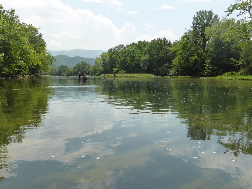
The Cove-Hopping Lake That Rewards People Who Bring a Kayak
Tims Ford Lake covers roughly 10,500 acres in Franklin and Moore counties in southern Middle Tennessee, with about 309 miles of twisting shoreline. TVA approved a new reservoir land-management plan for Tims Ford on August 10, 2026.
The lake has a different personality from the steep East Tennessee reservoirs.
Long fingers of water reach between wooded points. Islands interrupt the horizon. Narrow coves create places where a kayak can disappear from the main channel in minutes.
The water is not just pretty in photographs. TWRA specifically references clear water and cobble-and-boulder habitat as part of what makes Tims Ford such good smallmouth bass country.
That rock matters when the sun is high.
Instead of every shallow edge turning brown and muddy, many stretches keep that clean, rocky-lake look people hope for when they hear the words “clear water.”
Here’s what catches people off guard.
TWRA lists 14 public boat-access sites around Tims Ford with no launch fee.
That makes this one especially appealing if the goal is simply to get a kayak, canoe, or fishing boat onto the water without turning the day into a resort bill.
The insider tip is to think in coves, not beaches.
Tims Ford is at its best when you use the shoreline shape to your advantage. Paddle into one of the quieter fingers, slow down, and let the open-water traffic keep moving without you.
TVA’s Tims Ford Blueway is designed around exactly that idea, with paddle routes running through the reservoir and tributaries for everything from short outings to longer trips.
Tims Ford State Park gives visitors another established base with camping, cabins, boat access, and recreation.
Pack a dry bag, plenty of drinking water, sun protection, and a real lake map if you are paddling farther than a short shoreline loop. The maze-like coves that make Tims Ford fun can also make everything look strangely similar on the return trip.
The trap is treating a quiet cove like a private swimming pool. Boats can appear quickly around points, so stay visible and out of main traffic channels whenever possible.
This is the easygoing lake on the list.
The next one adds white sand, a national forest, and one of the most famous whitewater rivers in America just down the road.
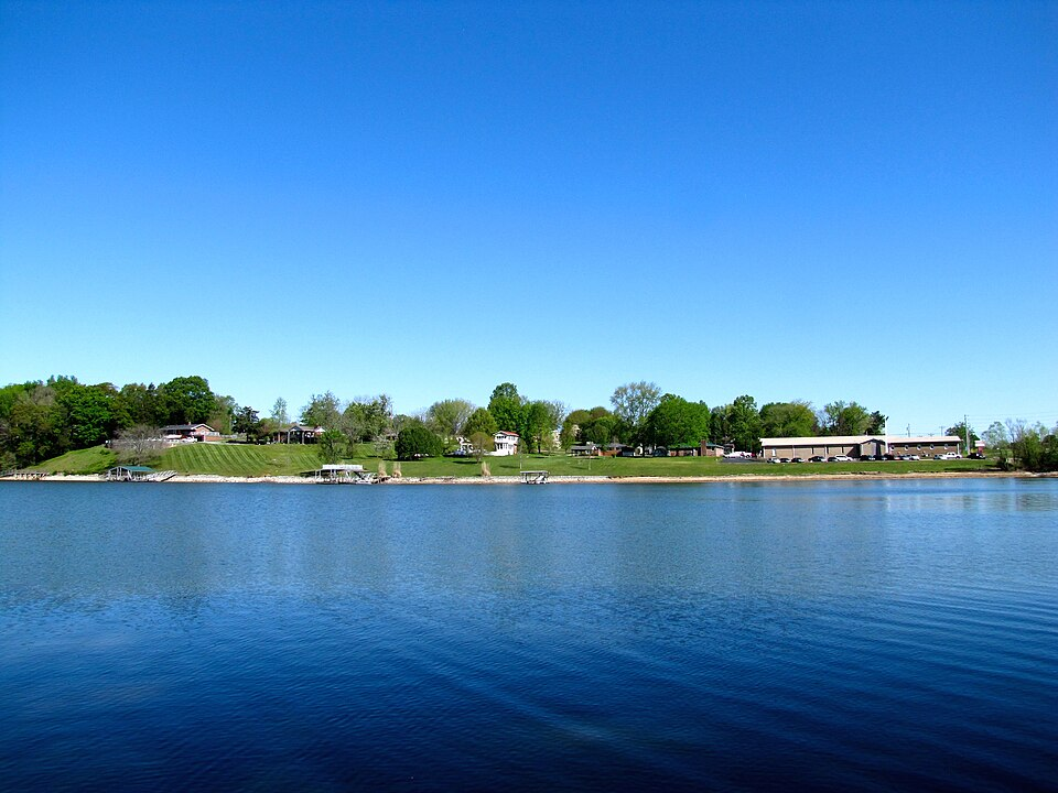
The White-Sand Lake Most Travelers Race Past on the Way to the Ocoee
Parksville Lake, also called Lake Ocoee, sits east of Cleveland in Cherokee National Forest beside the Ocoee Scenic Byway. The reservoir is surrounded by mountain scenery, yet plenty of travelers know the river far better than the lake sitting right beside it.
That is their mistake.
Parksville has the kind of shoreline that makes a cooler and a folding chair feel like a complete vacation plan.
Mountain ridges surround the water. Forest runs almost to the edge. In the quieter stretches, the lake can turn glassy enough to mirror the hills above it.
Then there is the sand.
Mac Point Beach sits on a small peninsula jutting into Lake Ocoee, with a white-sand swimming area, shaded picnic tables, grills, and nearby restroom and changing facilities.
Here’s what catches people off guard.
You can spend the morning on a white-sand mountain lake and the afternoon near the Ocoee River’s 1996 Olympic whitewater venue.
That combination is hard to beat.
The insider tip is to make Parksville the slow half of an Ocoee day. If rafting or sightseeing is on the schedule, do the lake when you want to cool down and stop moving.
Parksville Beach and Mac Point are the two names to remember for swimming. The lake also has boat access, paddling, fishing, and nearby camping.
Bring your own food and drinks rather than expecting a commercial beach strip. This is Cherokee National Forest, not Panama City Beach with mountains added.
Alcohol is prohibited at Forest Service campground facilities such as Parksville Lake RV Campground, and pets must be leashed there.
The trap is driving through too quickly.
The Ocoee gets the headlines because whitewater is dramatic. Parksville is quieter, which is exactly the point.
Give it a sunny afternoon and the lake starts making a strong argument for skipping the coast altogether.
There is one more lake, though, and it has something surprisingly close to an actual hometown beach.
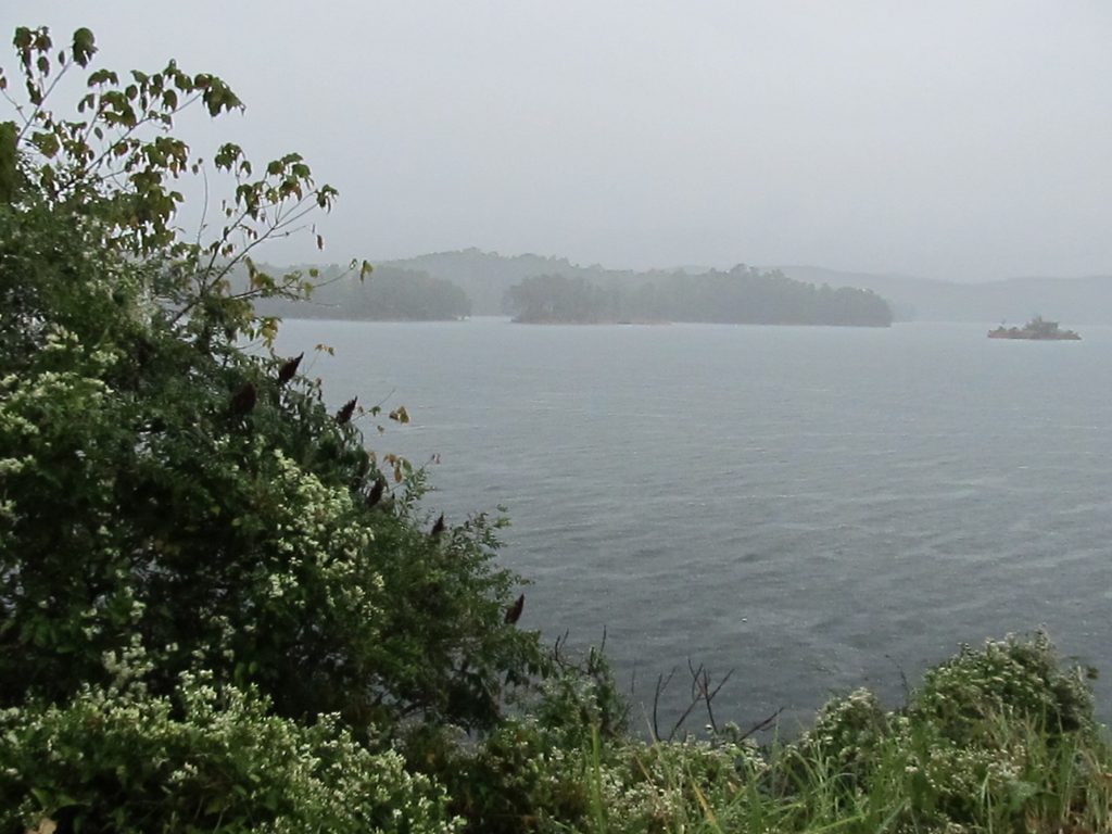
The Mountain-Fed Beach That Knoxville Visitors Keep Overlooking
Tellico Lake stretches about 33 miles into East Tennessee and covers roughly 15,560 acres, with 357 miles of shoreline across Loudon, Blount, and Monroe counties. Tellico Dam was completed in 1979, making it the last dam TVA built on the Tennessee River system.
Tellico feels broad and open compared with some of the narrower mountain reservoirs.
You get long views across blue-green water, wooded shorelines, and the first folds of the Appalachians rising beyond the lake.
At the Tellico Dam Reservation, the experience gets downright beachy.
There is sand. There is a marked swimming area. There is a paved trail. Parking sits close enough that hauling chairs and a cooler does not feel like a backcountry expedition.
TVA upgraded the recreation area with new beach sand and additional parking, and its own feature on Tellico highlights the swim beach near Bussell Island.
Here’s what catches people off guard.
TVA describes the water at Tellico’s swim beach as clear and clean, and the beach is one of 12 TVA swimming beaches across its system.
The insider tip is to walk after you swim.
The paved Beach Trail runs about two miles along the reservoir and gives you views of Tellico Dam, the lake, and the Lenoir City side of the water. TVA lists parking, bathrooms, and ADA accessibility along the trail.
TVA recreation day-use areas generally do not charge an entrance fee, which gives Tellico a serious advantage over a full-scale beach getaway.
Bring sandals or water shoes, sunscreen, drinking water, and shade if you are staying through the hottest part of the afternoon.
And use the marked swimming area rather than treating every piece of shoreline as a beach.
The trap is assuming the clearest-looking day automatically means the safest swimming day. Heavy rain can wash sediment and bacteria into natural water, and clarity can change considerably from one week to the next.
That applies to every lake in this story.
A beautiful surface is an invitation to look closer, not permission to stop paying attention.
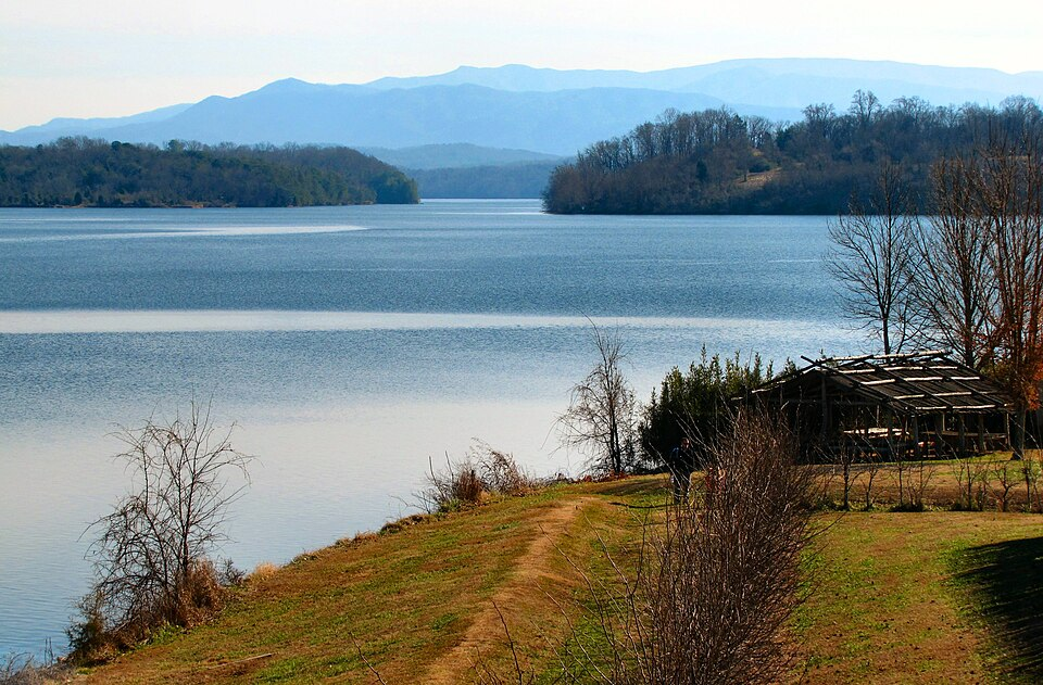
The Unexpected Fact About Tennessee’s Clear-Water Lakes
The prettiest thing about these lakes may actually be the thing you cannot see.
Clear water is not a permanent label. Rainfall, algae, sediment, boat traffic, reservoir levels, dissolved oxygen, and watershed conditions all change through the year. TVA evaluates reservoir health using far more than appearance, and a lake that looks transparent from shore is not automatically free of bacteria or other problems.
That is why the best Tennessee lake days usually come with a little homework. Check current park or agency notices, pay attention to recent heavy rain, use designated swimming areas when available, and do not assume an old photo tells you what the water looks like today.
Still, the larger point holds.
Tennessee may not have an ocean, but it has mountain water, sandy beaches, forested coves, paddle trails, houseboats, submerged history, and enough shoreline to make a seven-hour drive south feel optional.
Sometimes the best beach trip is the one that never gets anywhere near the beach.