
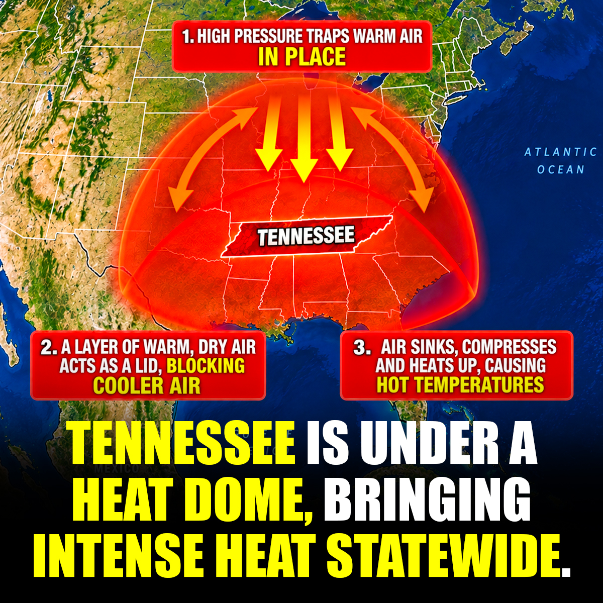
Fall may be close on the calendar, but much of Tennessee is still stuck in serious summer heat.
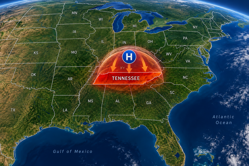
A large area of high pressure — often called a heat dome — has settled over the region, helping push temperatures into the upper 90s and, in some places, near or above 100 degrees. The National Weather Service says heat advisories are in effect across parts of West, Middle and East Tennessee as the hot pattern stretches toward the weekend.
For Tennesseans who are ready for cool mornings, hoodies and the first real hint of fall, this is not exactly the September weather they ordered.
And the heat is more than uncomfortable. In some areas, the combination of temperature and humidity could make it feel well above 100 degrees.
What exactly is a heat dome?
Despite the dramatic name, there is not a literal dome sitting over Tennessee.
A heat dome happens when a strong area of high pressure becomes established high in the atmosphere and stays in roughly the same place. Air sinks underneath that high pressure. As it sinks, it warms.
High pressure can also limit cloud development and rain, allowing sunshine to keep heating the ground day after day.
WSMV meteorologists pointed to that persistent pattern as the reason Tennessee has remained unusually hot this late in September. Middle Tennessee temperatures have already reached triple digits several times this month, according to the station.
That is why one hot afternoon can turn into several hot days in a row. The weather pattern itself is slow to move.

Middle Tennessee could feel hotter than 100 degrees
The National Weather Service office in Nashville says much of Middle Tennessee remains under a Heat Advisory through Saturday evening.
High temperatures are expected to push through the 90s and approach 100 degrees in some locations, while afternoon heat index values can rise above 100.
For Nashville specifically, the National Weather Service forecast called for a Thursday high around 101 degrees, with heat index values potentially reaching 107 degrees. Nearby Franklin had a forecast high around 99, with a possible heat index as high as 104.
WSMV's forecast also showed temperatures hanging near 99 degrees through the end of the workweek, with the hottest afternoons threatening daily temperature records.
That is a remarkable amount of heat for the second half of September, when Middle Tennessee normally would be beginning its slow slide toward more comfortable fall temperatures.
West Tennessee isn’t getting much relief either
The heat is not just a Nashville story.
The National Weather Service office in Memphis says hazardous heat is expected to continue into the weekend, with high temperatures ranging from about 97 to 103 degrees across its forecast area.
Heat index values could reach 109 degrees in parts of the Mid-South.
The Memphis area is also dealing with an air-quality concern. The weather service reported an ozone alert affecting the metro area, with conditions potentially unhealthy for groups including children, older adults and people with heart or lung conditions.
So in West Tennessee, the story is not simply “September feels hot.”
It is the kind of heat that can change outdoor plans, school practices, construction schedules and how long people safely spend outside.
East Tennessee is feeling the same stubborn pattern
East Tennessee has not escaped the high-pressure system.
The National Weather Service in Morristown says abnormally warm weather will continue into the weekend as a large ridge of high pressure remains over the region. Heat advisories were also posted within the office's forecast area.
There may be a few showers around the mountains as the week goes on, but forecasters said much of the region will stay dry.
That means the same basic weather setup stretches across a large chunk of the state: persistent high pressure, lots of heat and limited opportunities for cooler air to take control.
The calendar can be misleading
September is one of those Tennessee months that can fool people.
Football is back. Pumpkin displays have returned to stores. Fall festivals are appearing on calendars. There is every cultural sign that summer should be packing up.
The atmosphere does not read the calendar.
WSMV reported that average mid-September highs in Middle Tennessee are generally in the low to mid-80s. During this heat spell, temperatures have been running roughly 15 degrees warmer than that at times.
That gap helps explain why this weather feels especially strange.
A 98-degree afternoon in July is miserable but familiar.
A 98-degree afternoon when October is less than two weeks away feels like summer has missed its exit.
The heat index is the number to watch
The actual air temperature tells only part of the story.
Humidity can make hot weather feel even hotter because it slows the body's ability to cool itself through sweating. That combined effect is reflected in the heat index, sometimes called the “feels-like” temperature.
That is why a forecast high in the upper 90s can become a heat index of 105 or higher.
The National Weather Service recommends drinking plenty of fluids, limiting time in direct sunshine, spending time in air conditioning when possible and checking on relatives and neighbors during periods of dangerous heat.
Extra care is especially useful for people doing outdoor work, athletes and anyone who has to spend long periods outside.
And the usual hot-car warning still applies: never leave children or pets inside a parked vehicle.
There is finally some cooler weather in sight
The heat dome will not last forever.
WSMV's forecast indicates that more clouds and moisture should begin moving into Middle Tennessee early next week, bringing better chances for scattered showers and thunderstorms and helping temperatures back away from the upper 90s.
A stronger cold front could bring a more noticeable change by the middle to latter part of next week. WSMV's forecast had many areas returning to highs in the 80s, with parts of the Upper Cumberland potentially staying in the 70s on a day or two.
For now, though, Tennessee remains caught in an unusually hot September stretch.
The pumpkin spice can stay.
You may just want to drink it iced.
Sources
WSMV, “How the ‘heat dome’ is affecting Tennessee,” published Sept. 16, 2026. View WSMV report
WSMV, “Why is Tennessee so hot right now? Explaining the cause of triple-digit temps as fall nears.” Read the WSMV weather report
National Weather Service Nashville. NWS Nashville forecast and alerts
National Weather Service Memphis. NWS Memphis forecast and alerts
National Weather Service Morristown. NWS Morristown forecast and alerts